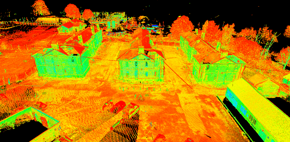
3D laser scanned measured building and elevation survey
Mayer Brown was commissioned by Grainger PLC, to carry out a measured building and elevation survey of McGrigor Barracks, Aldershot.
Infrastructure Design
Environmental Assessment
Details

Mayer Brown was commissioned by Grainger PLC, to carry out a measured building and elevation survey of McGrigor Barracks, Aldershot.
Grainger PLC was developing the site and converting the listed buildings of McGrigor Barracks into private accommodation. A measured building and elevation survey was therefore required.
The most cost effective and efficient way to provide this information was deemed to be a 3D laser scan of the buildings. From this information, conventional floor plans, elevations and sections could be drawn up.
Mayer Brown used a Scan Station P40, the latest scanning technology from Leica Geosystems, which has the capability to provide one million points of three dimensional data, per second at distances of up to 270m.
The scanner was used externally and internally to build up a three dimensional point cloud of data, capturing billions of points. The data was processed in Leica Cyclone software, which ties together all the individual scans to give an ordered accurate three dimensional model.
From here the data can be output into many different formats, enabling the user to build a REVIT model for BIM or more conventional applications such as AutoCAD sections and elevations.
Floor plans, elevations and sections were then drawn up in AutoCAD by slicing through various segments of the scanned image. The accuracy of scan data far surpasses conventional surveying methods and is particularly useful for listed buildings and buildings of historical importance.
For further information please contact enquiry@mayerbrown.co.uk.
Please leave us your details and we will endeavour to call you back as soon as we can.


