Infrastructure Design
Environmental Assessment
Details
Our initial involvement was for provision of planning reports relating to Flood Risk Assessment and Drainage Strategy. Our commission subsequently extended into verification of river modelling, requested by the Environment Agency, and then to addressing the reserved matters planning conditions.
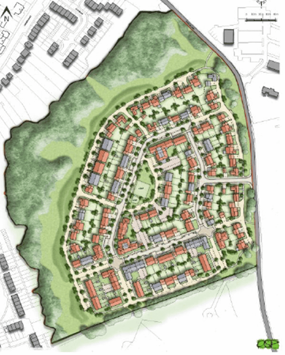
The site is located at a former golf club site which benefited from a housing allocation within the Adopted Waverly Local Plan. The development proposed and subsequently approved is for up to 200 new dwelling houses including access, Suitable Alternative Natural Green Space (SANG) provision and associated infrastructure.

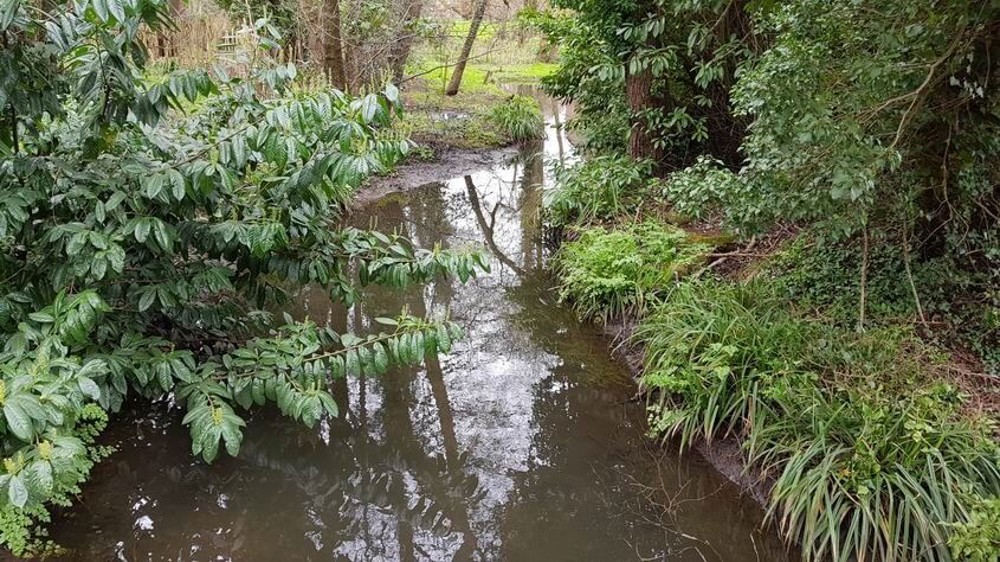
The key challenge was to support a development that would maximise the potential of the site whilst addressing and mitigating the risk of flooding from the adjacent River Ock, a tributary of the River Wey.
How our Services Were Put to Use for the Station Lane, Milford Residential Development
We verified river modelling undertaken to confirm safe finished floor levels for the development. These were set with 600mm freeboard above the 1 in 100-year return period event flood level with a 35% increase in peak river flow to account for climate change effects.
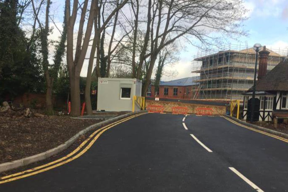
We produced a preliminary civil engineering levels and drainage design to address the reserved matters, satisfy the planning authority’s SuDS Hierarchy and comply with the national Non-Statutory Technical Standards for SuDS and the NPPF. SuDS designed for the site included filter trenches, permeable paving and attenuation tanks.
An agreement was reached with Natural England to provide boardwalks within the floodplain area to
Outline planning permission was granted by Waverley Borough Council in February 2019 and the Reserved Matters application was submitted in July 2019. The EA confirmed in September 2019 that all flood risk and drainage concerns have now been addressed.
For further information please contact slecocq@mayerbrown.co.uk

Lidl Great Britain Limited appointed Mayer Brown to provide transport planning support for a proposed new 2,164sqm foodstore on the site of former National Highways depot in Segensworth, Fareham.

Mayer Brown’s Isle of Wight Office was instructed by Mr and Mrs Grant to provide planning and detailed civil engineering infrastructure design services for a residential development of fourteen…

Mayer Brown takes pride in delivering comprehensive Transport Planning services for the successful delivery of residential and mixed-use developments. We were appointed to provide a package of…

Mayer Brown has been working with the Royal Surrey NHS Foundation Trust in Guildford since 2020 to tackle some of its biggest challenges: parking and accessibility. (Cover photo from Lee Vincent AJ…
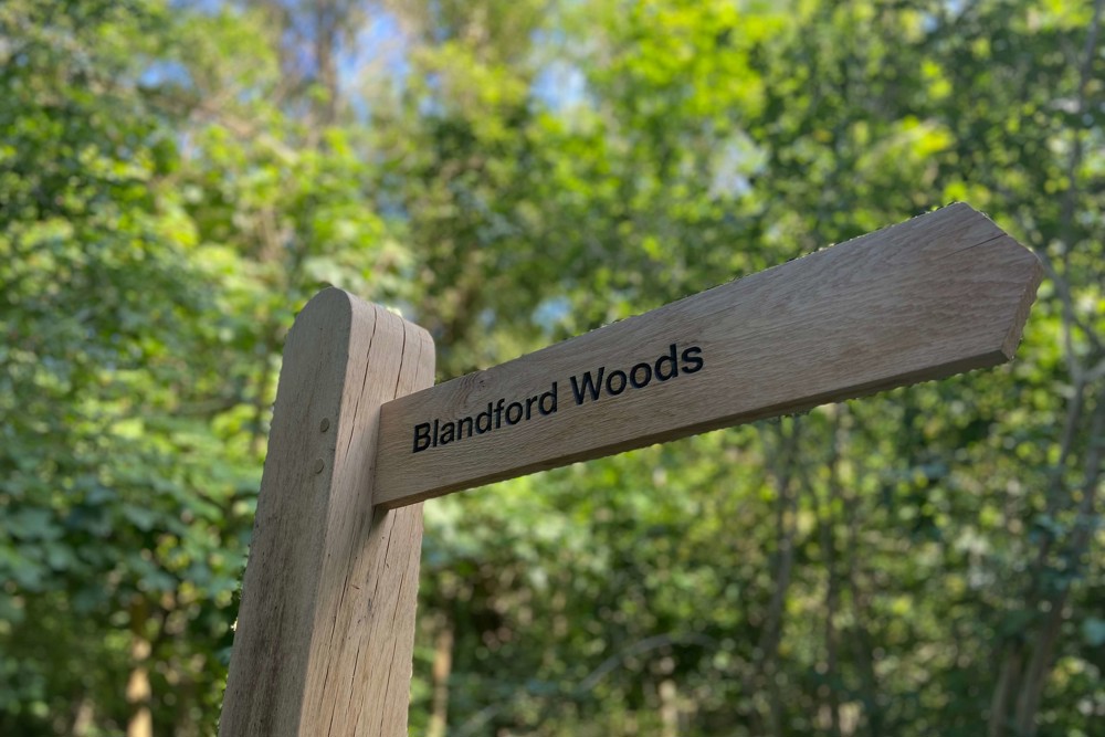
Mayer Brown were commissioned by Grainger plc to undertake design work associated with the provision of a Suitable Alternative Natural Greenspace (SANG), known as “Blandford Woods” in Aldershot. The…

Gleeson Land appointed Mayer Brown at the earliest stage of site promotion to provide strategic flood risk and drainage advice for land at Bewley Road, Angmering, West Sussex. From the outset, the…

The introduction of TfL’s new Road Safety Audit procedure, S2251, marks a change in how road safety is governed, assured and delivered across the Transport for London Road Network (TLRN).
Please leave us your details and we will endeavour to call you back as soon as we can.