As virtual reality (VR) technology advances and becomes increasingly accessible, it’s inevitable that it will become a greater part of the planning process, both for transport planning and urban design.
The potential and benefits for using VR in the planning process is enormous and includes:
- Making complex architectural and engineering concepts accessible to those without specialist expertise. For example, local authority teams, the general public and investors.
- Showcasing planning options that include tangible ‘before and after’ modelling to demonstrate the real-life effects of planned developments in building and transport.
- Monitoring projects as they develop, giving greater potential to make any necessary adjustments.
- Allowing more informed decision making by all of those involved in the planning process, including service users and the general public.
So what’s the current state of play regarding the use of VR in the planning process? How is it being used and what are planners doing with it?
VR now
Let’s start by looking at some recent examples of VR in urban planning.
Innovative use of VR developed by Californian VR specialist Eon Reality, was used in the creation of the Katara Cultural Village in Doha. Eon Reality created a VR model that people were able to walk through, experiencing what the proposed plans would be like in reality.
Similarly, French company Toolz has created Smart Favela, a town planning application which works a bit like a digital game, and which can be accessed on personal devices of multiple users.
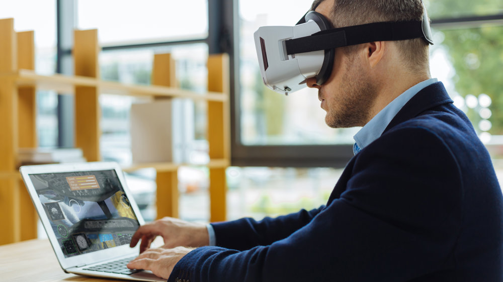
However, the use of the term ‘VR’ can be misleading. In reality, while urban planners and transport engineers are making increasing use of digital imagery that simulates reality, in most cases it’s ‘AR’ rather than ‘VR’.
What is AR and how is it used in urban and transport planning?
AR is augmented reality. It’s an image of a physical, real-world environment, which has features augmented and modified by computer-generated or extracted real-world sensory input such as video or graphics. It differs from VR, because although it enhances the user’s perception of reality, it will be an on-screen experience, using vision and sometimes including sound. This differs from VR which is an all surrounding experience, replacing the real world with a simulated one and altering the perception of the user.
When it comes to urban regeneration projects and highway design, it is more likely to be AR which is currently being used. Right now, it’s being used for desk-based walkarounds or projects, giving 3D information on development and construction.
While it isn’t fully immersive, it is a tremendously useful tool in the planning process, offering a very much stronger representation of the planned project than that which is possible using traditional 2D plans.
Computer generated images of roads and buildings can be superimposed into real life landscapes. It can also be used by architects and engineers to transform 2D drawings and designs into animated 3D visualisations.
Benefits of augmented reality
The benefits of AR are already being widely used and will no doubt continue to expand in their potential and ingenuity. Technology will develop, along with the creativity of designers. Add to this the input of professionals involved in urban renewal and transport infrastructure, such as consultant engineers and architects and it’s a very promising mix.
AR is a very practical tool. It doesn’t require the use of goggles and can be easily accessed on personal devices including phones and tablets. This gives it site-specific usage as well as the portability to ensure the involvement of all those affected by any development: from local authorities to businesses and services, as well as those involved in construction logistics and the wider public who will be affected by any development.
AR can be used to visualise road improvements and can bring a real-world dimension to modelling that will help to create increased safety as well as more efficient road use. Environmental factors can also be a clear part of the AR technology used, helping developers to minimise environmental impact while maximising efficiency and practicality for road users.
360-degree cameras can be part of AR transport planning simulation. Incorporating their use into the technology can demonstrate visibility on roads and at junctions, while also monitoring current road usage as part of traffic surveys and assessment.
Paramics: AR in action
Paramics is an excellent example of how these new technologies are currently being used for highway design and transport planning in the UK.
Paramics is traffic microsimulation software developed by Quadstone Paramics. This technology has proved popular at public exhibitions, where it has always been positively received.
Originally established in the early 1990s by the Department for Transport, it was further developed as a project by the Edinburgh Parallel Computing Centre, based at the University of Edinburgh. In the mid-1990s, some of the project staff left to form Quadstone Limited.
Paramics uses microsimulation that enables users to simulate individual vehicle movements to predict future travel pattern behaviour as a result from a change in traffic volume or road layout. This allows for real time vehicle movement. It’s also able to simulate queuing conditions on congested roads and at junctions. It’s being used by a range of parties involved in transport planning, from local authorities and central government to engineering consultants and universities. It’s used in multiple aspects of transport planning, including public transport and environmental impact assessment, as well as planning for highways, junctions, roundabouts and all aspects of traffic engineering.
VR and AR are set to change our lives in multiple ways. For many, it starts in the home with things like gaming and shopping. However, the real effects with be in our everyday lives, affecting practical concerns like safety, transportation, our living conditions and social spaces. It even has implications for how food will be made available to a growing population. The role of VR and AR in transport planning, environmental assessment and urban design is making big waves, but this is just the beginning. The potential is huge and limited only by our imagination and thirst to create a better world for everyone to live in.